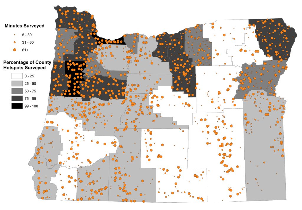
Statewide Hotspot Square Coverage
As part of our County Explorer Project, we established Hotspot Squares to provide more evenly distributed coverage of statewide bird data, and encourage participants to count birds in new areas. We ask all participants to enter their Hotspot bird data into eBird.org. This makes the count data available to researchers like ourselves as well as other birders.
After the last eBird database update (April 2016), we downloaded all publicly available bird survey data from Oregon2020 Hotspot Squares. You’ll see the results below, with full discussion on the new Project Status page.


Leave A Comment
You must be logged in to post a comment.